
Lianhuashan Park to Civic Center: A Shenzhen Skyline Walk
Start at Children’s Palace Metro, enter the south side of Lianhuashan Park and climb to the Deng Xiaoping statue for the Futian skyline. Come back down on the same side and continue to the plaza under the Civic Center’s roof. Allow around two hours, or give yourself longer if you want to watch the sky change at the viewpoint. Start the uphill section during daylight so you can see the signs on the return.
1. Take Line 3 or 4 to Children’s Palace
Search for Children’s Palace 少年宫 on the Shenzhen Metro, served by Lines 3 and 4. For the lawn route, take Exit F1 and follow the park approach from the Civic Center side. The park authority’s access listing puts F1 about 160 metres from the park’s south-side lawn area. If you want the approach specifically marked South Gate 南门, Shenzhen Traffic Police lists Exit E separately. Save 莲花山公园南门 on your phone if you plan to return to that gate.


The city maps the walk as part of the Lianhua Hill–Civic Center route. You may see either Lianhua Hill Park or Lianhuashan Park in English. Both refer to 莲花山公园. Keep the Chinese name handy if you need to ask for the park gate.
2. Pass the open lawn before you go uphill
From the south approach, look for the broad southern lawn, often labelled 风筝广场 (Kite Square). Make it your first waypoint. The open field is easy to identify among the trees, and you can see high-rise buildings above the far side. If the climb feels unappealing in the heat, make a short lap around the lawn and skip straight to Civic Center. You will still get a sense of how close the park is to Futian’s office towers.


3. Follow the signs to the summit square
Near the lawn, look for 山顶广场 (Summit Square) or 邓小平铜像 (Deng Xiaoping bronze statue). Choose a paved uphill path and follow the next matching sign at each junction. If you want fewer steep sections, stay on a broad, winding uphill path whenever the signed choice is available. Allow roughly 20–35 minutes uphill from the south side at an unhurried pace. Leave more time in hot weather or when the area is crowded. The published time here is a planning allowance, and the trails split in several places.


The city’s park listing gives 06:00–23:00 for the grounds, with last entry at 22:30. Use a daytime or early-evening start and follow any separate restrictions posted for the summit area. Save your way down or photograph the junction you used. It is much easier to recognise the same junction than to choose a second way down in dim light.
4. Cross the summit square to the skyline side
When you see the statue, you have reached the correct upper square. Walk across the plaza to the edge facing the high-rises. Look down first for the broad civic buildings below the hill, then look further out for the taller Futian buildings. The long roof visible below marks Civic Center, which is the next stop. Choose an open stretch of railing if the middle is busy. In haze, the nearer building shapes may still be visible even if the distant skyline has faded.


5. Go back to the south side and finish at Civic Center Square
Descend toward the South Gate or the lawn you passed on the way in. Switch your map to 市民中心广场 (Civic Center Square) once you are back on relatively flat ground, then follow the pedestrian approaches of the central axis. Use the marked crossings and connections instead of trying to cross Hongli Road at the first sight of the roof. You have reached the square when the wide Civic Center roof and its coloured supports are ahead of you at plaza level.
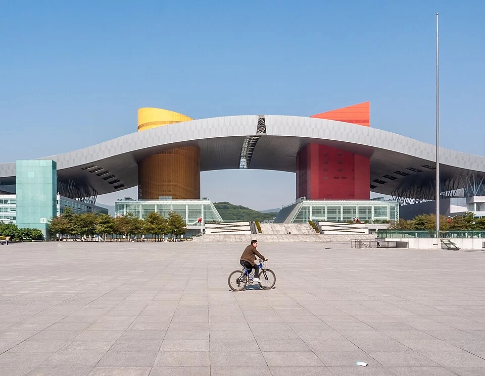

From the square, set your onward route from Civic Center 市民中心 station (Lines 2 and 4) or return to Children’s Palace 少年宫 if that serves your line more directly. In heavy rain, skip the climb and use the metro between your hotel and the Civic Center area, saving the hill for clearer weather. For the subway map, use the city’s Shenzhen Metro lines guide.